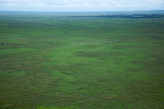
File:Sabana del Beni - Bolivia.jpg

Size of this preview: 640 × 425 pixels.
| |
This is a file from the Wikimedia Commons. Information from its description page there is shown below.
Commons is a freely licensed media file repository. You can help. |
| Description | vista aérea del los llanos del Beni o sabana, una de las ecorregiones más grandes de Bolivia. | |||||||
| Date | 18 January 2009, 08:20:50 | |||||||
| Source | originally posted to Flickr as Pastizales de Beni | |||||||
| Author | Sam Beebe
|
|||||||
| Permission ( Reusing this file) |
|
File usage
The following pages on Schools Wikipedia link to this image (list may be incomplete):
Metadata
This file contains additional information, probably added from the digital camera or scanner used to create or digitize it. If the file has been modified from its original state, some details may not fully reflect the modified file.
| Camera manufacturer | NIKON CORPORATION |
|---|---|
| Camera model | NIKON D90 |
| Exposure time | 1/1,250 sec (0.0008) |
| F-number | f/5.6 |
| ISO speed rating | 400 |
| Date and time of data generation | 08:20, 18 January 2009 |
| Lens focal length | 48 mm |
| Latitude | 15° 56′ 23.4″ S |
| Longitude | 65° 5′ 40.2″ W |
| Altitude | 353 meters above sea level |
| Copyright holder | Creative Commons Attribution 3.0 |
| Author | Samuel M Beebe, Ecotrust |
| Pixel composition | RGB |
| Orientation | Normal |
| Horizontal resolution | 72 dpi |
| Vertical resolution | 72 dpi |
| Software used | Ver.1.00 |
| File change date and time | 08:20, 18 January 2009 |
| Exposure Program | Not defined |
| Date and time of digitizing | 08:20, 18 January 2009 |
| Exposure bias | 0 |
| Maximum land aperture | 4.5 APEX (f/4.76) |
| Metering mode | Pattern |
| Light source | Unknown |
| Flash | Flash did not fire, auto mode |
| DateTime subseconds | 00 |
| DateTimeOriginal subseconds | 00 |
| DateTimeDigitized subseconds | 00 |
| Colour space | sRGB |
| Sensing method | One-chip colour area sensor |
| Custom image processing | Normal process |
| Exposure mode | Auto exposure |
| White balance | Auto white balance |
| Digital zoom ratio | 1 |
| Focal length in 35 mm film | 72 mm |
| Scene capture type | Standard |
| Scene control | Low gain up |
| Contrast | Normal |
| Saturation | Normal |
| Sharpness | Normal |
| Subject distance range | Unknown |
| GPS time (atomic clock) | 14:20 |
| Satellites used for measurement | 09 |
| Reference for direction of image | Magnetic direction |
| Direction of image | 136.7 |
| GPS tag version | 2.2.0.0 |
| IIM version | 2 |
| Contact information | www.ecotrust.org |
| Country shown | Bolivia |
| Province or state shown | Cochabamba |
| Keywords |
|
| Credit/Provider | Samuel M Beebe, Ecotrust |
| Code for country shown | BOL |
Did you know...?
SOS Children's Villages has brought Wikipedia to the classroom. SOS Childrens Villages believes education is an important part of a child's life. That's why we ensure they receive nursery care as well as high-quality primary and secondary education. When they leave school, we support the children in our care as they progress to vocational training or higher education. You can help by sponsoring a child.
