
File:Gz-map2.png
Gz-map2.png (328 × 352 pixels, file size: 25 KB, MIME type: image/png)
| |
This is a file from the Wikimedia Commons. Information from its description page there is shown below.
Commons is a freely licensed media file repository. You can help. |
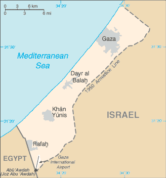
| Description | A map of the Gaza Strip | |||
| Date | Taken from CIA World Factbook website on 28 August 2006. Please note that this is not the original CIA map; it has been edited to remove the text Israeli-occupied with current status subject to the Israeli-Palestinian Interim Agreement - permanent status to be determined through further negotiation (compare e.g. ). | |||
| Source | CIA World Factbook | |||
| Author | CIA | |||
| Permission ( Reusing this file) |
Public domain, as is all content from the CIA factbook
|


File usage
The following pages on Schools Wikipedia link to this image (list may be incomplete):
Metadata
Schools Wikipedia and SOS Children
SOS Childrens Villages aims to make Wikipedia suitable for young learners. SOS Childrens Villages believes that a decent childhood is essential to a happy, healthy. Our community work brings families new opportunities through education, healthcare and all manner of support. There are many ways to help with SOS Children's Villages.