 |
This is a file from the Wikimedia Commons. Information from its description page there is shown below.
Commons is a freely licensed media file repository. You can help.
|
|
Camera location
|
56° 11′ 47.01″ N, 4° 45′ 52.10″ W
|
This and other images at their locations on: Google Maps - Google Earth - OpenStreetMap |
( Info)56.196392;-4.764473 |
| Description |
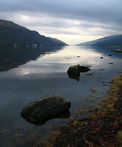
Loch Long, near to Ardmay, Argyll and Bute, Great Britain. Looking down the Loch from the torpedo testing facility. The houses to the left are at Ardmay. |
| Date |
15 November 2007 |
| Source |
Geograph |
| Author |
Steve Partridge |
Permission
( Reusing this file) |
Creative Commons Attribution-Share Alike 2.0 Generic
|
 |
This image was taken from the Geograph project collection. See this photograph's page on the Geograph website for the photographer's contact details. The copyright on this image is owned by Steve Partridge and is licensed for reuse under the Creative Commons Attribution-ShareAlike 2.0 license. |
File usage
The following pages on Schools Wikipedia link to this image (list may be incomplete):
This file contains additional information, probably added from the digital camera or scanner used to create or digitize it. If the file has been modified from its original state, some details may not fully reflect the modified file.


