
File:Madaba map.jpg
| |
This is a file from the Wikimedia Commons. Information from its description page there is shown below.
Commons is a freely licensed media file repository. You can help. |
| Description |
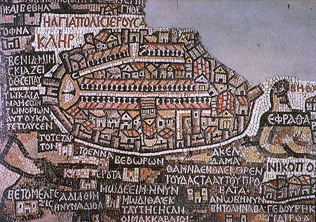
Mosaico de Mandaba del siglo VI. Mosaico realizado circa 570 para decorar el suelo de una iglesia bizantina en Mandaba, Jordania. Muestra la región de Jordania y Palestina al norte y Egipto al sur, e incluye un plano de Jerusalén en el que se aprecia a la izquierda la puerta norte, de la que parte el Cardus Maximus en dirección sur. El mapa se encuentra en la iglesia ortodoxa de San Jorge, construída en 1896 sobre los restos de la Iglesia bizantina original, aunque solo se conserva un fragmento. Originalmente medía 25 x 5 metros. |
| Date | 19 August 2005 |
| Source | W:en:Image:Madaba_map.jpg http://www.mcah.columbia.edu/dbcourses/islamic/large/madaba_map.jpg |
| Author | W:en:User:Brandmeister |
 |
This image (or other media file) is in the public domain because its copyright has expired. This applies to Australia, the European Union and those countries with a copyright term of life of the author plus 70 years.
|
|
|
|
File usage
Schools Wikipedia facts
SOS Children chose the best bits of Wikipedia to help you learn. Thanks to SOS Childrens Villages, 62,000 children are enjoying a happy childhood, with a healthy, prosperous future ahead of them. Learn more about child sponsorship.