 |
This is a file from the Wikimedia Commons. Information from its description page there is shown below.
Commons is a freely licensed media file repository. You can help.
|
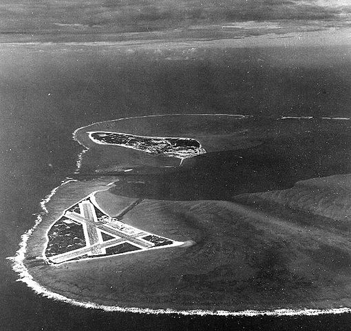
Caption: Midway Atoll. Aerial photograph, looking just south of west across the southern side of the atoll, 24 November 1941. Eastern Island, then the site of Midway's airfield, is in the foreground. Sand Island, location of most other base facilities, is across the entrance channel.
Source: http://www.history.navy.mil/photos/images/g450000/g451086.jpg
Licensing
| Public domainPublic domainfalsefalse |
 |
This file is a work of a sailor or employee of the U.S. Navy, taken or made as part of that person's official duties. As a work of the U.S. federal government, the image is in the public domain. |
|
|
This file has been identified as being free of known restrictions under copyright law, including all related and neighboring rights.
|
File usage
The following pages on Schools Wikipedia link to this image (list may be incomplete):
SOS Childrens Villages chose the best bits of Wikipedia to help you learn. SOS Children's Villages believes education is an important part of a child's life. That's why we ensure they receive nursery care as well as high-quality primary and secondary education. When they leave school, we support the children in our care as they progress to vocational training or higher education. We have helped children in Africa for many years - you can help too...


