 |
This is a file from the Wikimedia Commons. Information from its description page there is shown below.
Commons is a freely licensed media file repository. You can help.
|
 |
This is an image of a place or building that is listed on the National Register of Historic Places in the United States. Its reference number is 72000281.
|
| Description |
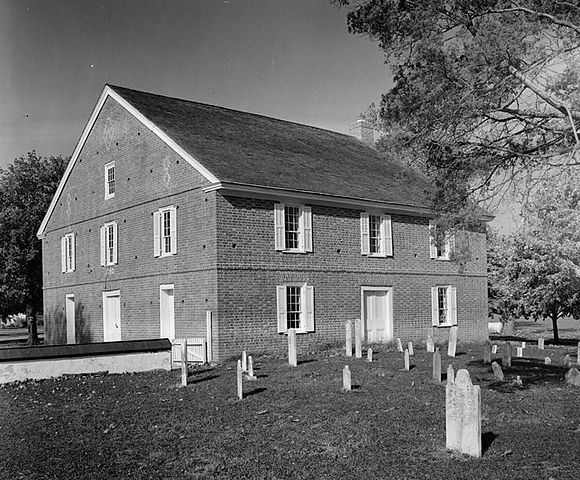
English: Old Barratt's Chapel (Methodist), Route 113, Frederica vicinity (Kent County, Delaware)cropped
 |
This file comes from the Historic American Buildings Survey (HABS), Historic American Engineering Record (HAER) or Historic American Landscapes Survey (HALS). These are programs of the National Park Service established for the purpose of documenting historic places. Records consist of measured drawings, archival photographs, and written reports.
When reusing please credit: Library of Congress, Prints & Photographs Division, DEL,1-FRED.V,2-8
This tag does not indicate the copyright status of the attached work. A normal copyright tag is still required. See Commons:Licensing for more information.
|
| Public domainPublic domainfalsefalse |
 |
This work is in the public domain in the United States because it is a work prepared by an officer or employee of the United States Government as part of that person’s official duties under the terms of Title 17, Chapter 1, Section 105 of the US Code. See Copyright. Note: This only applies to original works of the Federal Government and not to the work of any individual U.S. state, territory, commonwealth, county, municipality, or any other subdivision. This template also does not apply to postage stamp designs published by the United States Postal Service since 1978. (See 206.02(b) of Compendium II: Copyright Office Practices). It also does not apply to certain US coins; see The US Mint Terms of Use.
|
|
|
This file has been identified as being free of known restrictions under copyright law, including all related and neighboring rights.
|
|
| Date |
November 1982 |
| Source |
http://memory.loc.gov/pnp/habshaer/de/de0000/de0018/photos/304856pv.jpg |
| Author |
David Ames, Photographer |
|
Object location
|
39° 1′ 29.00″ N, 75° 27′ 34.00″ W
|
This and other images at their locations on: Google Maps - Google Earth - OpenStreetMap - Proximityrama |
( Info)39.024722;-75.459444 |
File usage
The following pages on Schools Wikipedia link to this image (list may be incomplete):
This file contains additional information, probably added from the digital camera or scanner used to create or digitize it. If the file has been modified from its original state, some details may not fully reflect the modified file.
All five editions of Schools Wikipedia were compiled by SOS Children's Villages. More than 2 million people benefit from the global charity work of SOS Childrens Villages, and our work in 133 countries around the world is vital to ensuring a better future for vulnerable children. There are many ways to help with SOS Children.


