
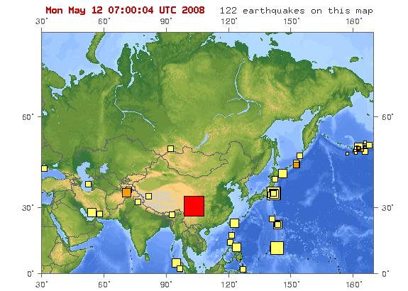
File:Map of epicenter of may 12 2008 earthquake in sichuan province china.gif
Map_of_epicenter_of_may_12_2008_earthquake_in_sichuan_province_china.gif (575 × 410 pixels, file size: 51 KB, MIME type: image/gif)
| |
This is a file from the Wikimedia Commons. Information from its description page there is shown below.
Commons is a freely licensed media file repository. You can help. |
Summary
| Description |
Map of epicenter of May 12, 2008 earthquake in Sichuan Province in China |
| Date | 12 May 2008 |
| Source | U.S. Geological Survey |
| Author | United States Geological Survey |
Licensing
 |
This image is in the public domain because it contains materials that originally came from the United States Geological Survey, an agency of the United States Department of the Interior. For more information, see the official USGS copyright policy. български | català | Deutsch | English | español | eesti | suomi | français | galego | italiano | 한국어 | македонски | മലയാളം | Nederlands | polski | português | русский | Türkçe | 中文 | 中文(简体) | +/− |
|
File usage
The following pages on Schools Wikipedia link to this image (list may be incomplete):
Want to know more?
Learning is fun and easy with Schools Wikipedia. SOS Childrens Villages works in 133 countries and territories across the globe, helps more than 62,000 children, and reaches over 2 million people in total. Find out more about sponsoring a child.