
File:Montserrat eruption.JPG
| |
This is a file from the Wikimedia Commons. Information from its description page there is shown below.
Commons is a freely licensed media file repository. You can help. |
| Description |
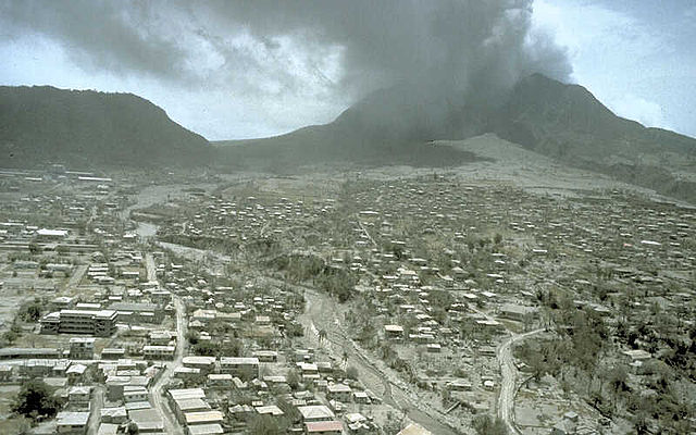
View E across ash-covered Plymouth, the former capital city and major port of Montserrat, toward Soufriere Hills volcano. Before the volcano became active in July 1995, about 5,000 people lived in Plymouth, located 4 km west of English's Crater. During the first two years of the eruption, ash and noxious gas from explosions and pyroclastic flows frequently settled on Plymouth. On August 3, about 3 weeks after this image was taken, the first significant pyroclastic flow swept through the evacuated town. The flow triggered many fires and caused extensive damage to buildings and community facilities by direct impact and burial. |
|||
| Date | 12 July 1997 | |||
| Source | http://volcanoes.usgs.gov/Hazards/Effects/SoufriereHills_PFeffects.html | |||
| Author | R.P. Hoblitt | |||
| Permission ( Reusing this file) |
|

File usage
The best way to learn
Through Schools Wikipedia, SOS Childrens Villages has brought learning to children around the world. SOS Childrens Villages believes that a decent childhood is essential to a happy, healthy. Our community work brings families new opportunities through education, healthcare and all manner of support. You can help by sponsoring a child.