
File:Amsterdam-topografie.jpg
Size of this preview: 485 × 479 pixels.
| |
This is a file from the Wikimedia Commons. Information from its description page there is shown below.
Commons is a freely licensed media file repository. You can help. |
Summary
| Description |
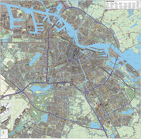
Nederlands: Topografisch beeld van de stad Amsterdam.
Op basis van de GML open geodata van de BRT/Top10NL (basisregistratie Topografie, Kadaster 2012), vrijgegeven door Kadaster op 30-11-2012 onder de Creative Commons BY licentie. Gebouwvlakken vanuit Open Geodata BAG extract (december 2012). Samenstelling en kleurenschema: Jan-Willem van Aalst, met QuantumGIS en Photoshop. |
| Date | 10 March 2012 |
| Source | Own work |
| Author | Janwillemvanaalst |
Licensing
|
File usage
The following pages on Schools Wikipedia link to this image (list may be incomplete):
Metadata
I want to learn more...
SOS Childrens Villages chose the best bits of Wikipedia to help you learn. Thanks to SOS Childrens Villages, 62,000 children are enjoying a happy childhood, with a healthy, prosperous future ahead of them. Have you thought about sponsoring a child?