
File:Map Europe alliances 1914-de.svg
Size of this preview: 640 × 380 pixels.
| |
This is a file from the Wikimedia Commons. Information from its description page there is shown below.
Commons is a freely licensed media file repository. You can help. |
| Description |
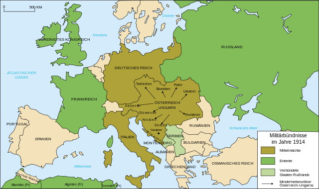
Deutsch: Karte von Militärbündnisse in Europa in 1914, (deutsch)
English: Map of military alliances of Europe in 1914. (German)
Français : Carte des alliances militaires en Europe en 1914 (Allemagne).
Русский: Схема военных альянсов в Европе в 1914 г. (нем.)
|
| Date | 2008-10-04 01:57 (UTC) |
| Source |
|
| Author |
|
| This is a retouched picture, which means that it has been digitally altered from its original version. Modifications: Into German, auf deutsch. The original can be viewed here: Map_Europe_alliances_1914-fr.svg. Modifications made by Danbornekde.
|
|
File usage
The following pages on Schools Wikipedia link to this image (list may be incomplete):
Metadata
Want to know more?
Wikipedia for Schools was collected by SOS Children. The world's largest orphan charity, SOS Childrens Villages brings a better life to more than 2 million people in 133 countries around the globe. Find out how you can help children in other countries.