
File:Map of the Auckland urban area, 2009, cropped.jpg
Size of this preview: 383 × 479 pixels.
| |
This is a file from the Wikimedia Commons. Information from its description page there is shown below.
Commons is a freely licensed media file repository. You can help. |
| Description |
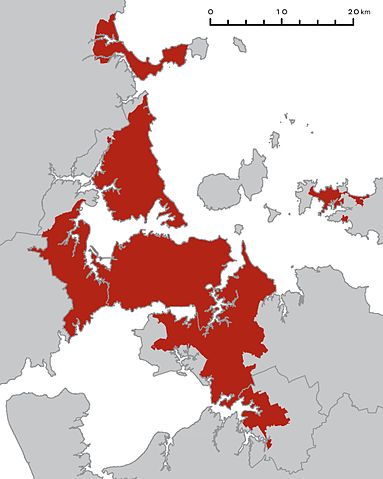
English: A map of the Auckland region with the Auckland urban area highlighted in red. The existing region and district boundaries are shown with grey lines; these are no longer current. North is at the top.
The coastline shown around Puketutu Island, east of Mangere, is inaccurate. It shows all the area between the island and the mainland (formerly occupied by sewage treatment ponds) as land. |
| Date | 2011-03-09 00:39 (UTC) |
| Source |
|
| Author |
|
| This is a retouched picture, which means that it has been digitally altered from its original version. Modifications: Cropped, scale moved, "Kilometres" shortened to "km". The original can be viewed here: Map_of_the_Auckland_urban_area,_2009.jpg. Modifications made by Avenue.
|
|
|||||||||||||||||||||

File usage
The following pages on Schools Wikipedia link to this image (list may be incomplete):
Schools Wikipedia and SOS Children
All five editions of Schools Wikipedia were compiled by SOS Children's Villages. The world's largest orphan charity, SOS Children brings a better life to more than 2 million people in 133 countries around the globe. There are many ways to help with SOS Childrens Villages.