
File:RegioniIrredenteItalia.jpg
Size of this preview: 368 × 480 pixels.
| |
This is a file from the Wikimedia Commons. Information from its description page there is shown below.
Commons is a freely licensed media file repository. You can help. |
Summary
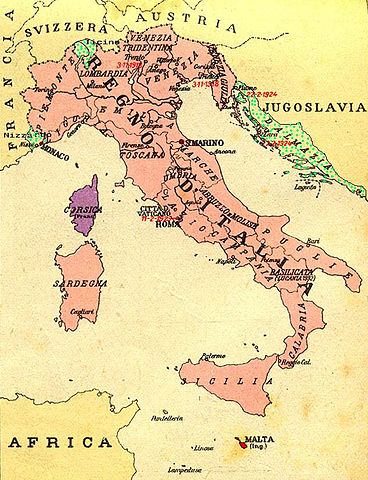
| Description | Map of Kingdom of Italy (1919) showing the areas claimed by Irredentism:in red Malta, in purple Corsica, in yellow with green points Dalmatia, Ticino and Nizzardo. I have used as a basic map an old map from an Italian geography & history school-book of 1935 "Scuole Medie Inferiori", and I have written and painted on it. Cropped caption: L’ Italia dopo la Guerra 1915-1918 |
| Date | April 2008 |
| Source | Own work |
| Author | Brunodambrosio |
Licensing
 |
I, the copyright holder of this work, release this work into the public domain. This applies worldwide. In some countries this may not be legally possible; if so: I grant anyone the right to use this work for any purpose, without any conditions, unless such conditions are required by law.
|
File usage
The following pages on Schools Wikipedia link to this image (list may be incomplete):
Learn more about Schools Wikipedia
You can learn about nearly 6,000 different topics on Schools Wikipedia. SOS Children's Villages works in 133 countries and territories across the globe, helps more than 62,000 children, and reaches over 2 million people in total. Find out how you can help children in other countries.