 |
This is a file from the Wikimedia Commons. Information from its description page there is shown below.
Commons is a freely licensed media file repository. You can help.
|
Summary
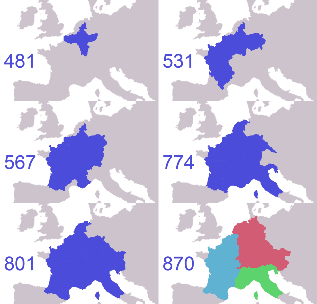
Expansion of the Franks, using Library of Texas Frankish power map, Image:843-870 Europe.jpg and Image:Western empire verdun 843.png. (Simplified for the purposes of the animation - Franks were not united in some periods; at many points they had different kings - frankish dominions shown at Image:ClovisDomain.jpg)
Note only shows saxony after it was completely subdued (804) although most sources say range (772-98 for instance); some maps show brittany controlled by franks.
Based on blank map of Europe from commons
Licensing
I, the copyright holder of this work, hereby publish it under the following license:
 |
Permission is granted to copy, distribute and/or modify this document under the terms of the GNU Free Documentation License, Version 1.2 or any later version published by the Free Software Foundation; with no Invariant Sections, no Front-Cover Texts, and no Back-Cover Texts. A copy of the license is included in the section entitled GNU Free Documentation License. http://www.gnu.org/copyleft/fdl.htmlGFDLGNU Free Documentation Licensetruetrue
|
|
File usage
The following pages on Schools Wikipedia link to this image (list may be incomplete):
Wikipedia for Schools brings Wikipedia into the classroom. Our 500 Children's Villages provide a home for thousands of vulnerable children. Beyond our Villages, we support communities, helping local people establish better schools and delivering effective medical care to vulnerable children. Want to learn more? Go to http://www.soschildrensvillages.org.uk/sponsor-a-child


