
File:Pedro De Valdivia Siedlungen in Chile 1540 bis 1553.jpg
Size of this preview: 149 × 478 pixels.
| |
This is a file from the Wikimedia Commons. Information from its description page there is shown below.
Commons is a freely licensed media file repository. You can help. |
| Description |
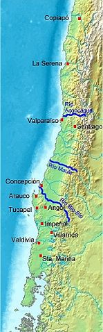
Deutsch: Karte von Chile. Pedro de Valdivia. Koloniale Siedlungen in Chile, 1540 - 1553
English: Map of Chile. Pedro de Valdivia. Locations of colonization in Chile, 1540 - 1553
Español: Mapa de Chile. Pedro de Valdivia. Fundaciones en Chile, 1540 - 1553
|
| Date | 2008-07-20 18:11 (UTC) |
| Source |
|
| Author |
|
| This is a retouched picture, which means that it has been digitally altered from its original version. Modifications: Orte eingezeichnet/locations added. The original can be viewed here: Map_of_Chile_Demis.png. Modifications made by WeHaKa.
|
|

File usage
The following pages on Schools Wikipedia link to this image (list may be incomplete):
Find out more
SOS Children's Villages has brought Wikipedia to the classroom. SOS Childrens Villages believes education is an important part of a child's life. That's why we ensure they receive nursery care as well as high-quality primary and secondary education. When they leave school, we support the children in our care as they progress to vocational training or higher education. There are many ways to help with SOS Childrens Villages.