
File:Tehran Urbanization.gif
Size of this preview: 480 × 480 pixels.
| |
This is a file from the Wikimedia Commons. Information from its description page there is shown below.
Commons is a freely licensed media file repository. You can help. |
Summary
| Description |
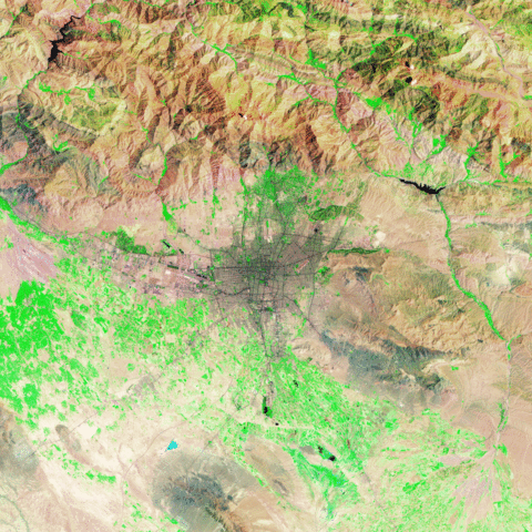
English: Tehran in 1985 and 2009. Vegetation appears bright green, urban areas range in colour from grey to black, and barren areas appear brown. Many additional roadways have been added, particularly in the north.
|
| Date | 20 November 2009 |
| Source | NASA Earth Observatory |
| Author | Robert Simmon |
Images captured by the Thematic Mapper sensor on NASA’s Landsat 5 satellite. Image created using Landsat data provided by the U.S. Geological Survey’s Global Visualization Viewer.
Licensing
 |
This file is in the public domain because it was solely created by NASA. NASA copyright policy states that "NASA material is not protected by copyright unless noted". (See Template:PD-USGov, NASA copyright policy page or JPL Image Use Policy.) |
 |
 |
Warnings:
|
File usage
The following pages on Schools Wikipedia link to this image (list may be incomplete):
More information
Schools Wikipedia was created by children's charity SOS Childrens Villages. SOS Childrens Villages works in 133 countries and territories across the globe, helps more than 62,000 children, and reaches over 2 million people in total. We have helped children in Africa for many years - you can help too...