
File:Northern segment of the second Tay Bridge.jpg
Size of this preview: 638 × 104 pixels.
| |
This is a file from the Wikimedia Commons. Information from its description page there is shown below.
Commons is a freely licensed media file repository. You can help. |
Summary
|
Camera location |
|
This and other images at their locations on: Google Maps - Google Earth - OpenStreetMap | ( Info) |
|---|
| Description |
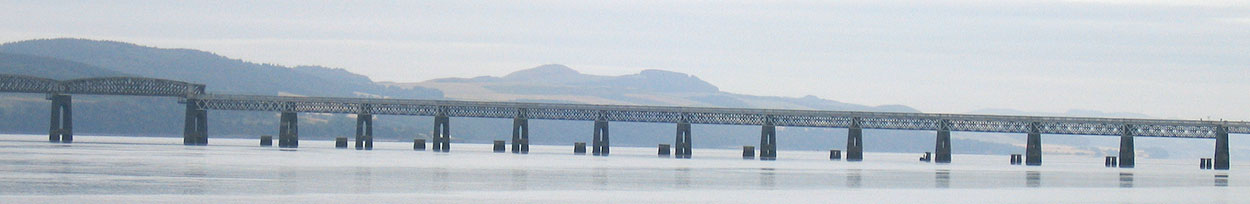
English: This is a northern segment of the second Tay Bridge, showing a section from the High Girders on the left, to the beginning of a shallower span on the right. The image also shows examples of the stumps of the first Tay Bridge poking out of the Tay.
|
| Date | 9 August 2005 |
| Source | Own work |
| Author | Denimadept |
Licensing
|
File usage
The following pages on Schools Wikipedia link to this image (list may be incomplete):
Metadata
Find out more
Schools Wikipedia has been carefully checked to give you the best learning experience. Thanks to SOS Children, 62,000 children are enjoying a happy childhood, with a healthy, prosperous future ahead of them. There are many ways to help with SOS Children's Villages.