
File:Volgarivermap.png
Size of this preview: 480 × 480 pixels.
| |
This is a file from the Wikimedia Commons. Information from its description page there is shown below.
Commons is a freely licensed media file repository. You can help. |
 |
This map image could be recreated using vector graphics as an SVG file. This has several advantages; see Commons:Media for cleanup for more information. If an SVG form of this image is already available, please upload it. After uploading an SVG, replace this template with {{ vector version available|new image name.svg}}. |
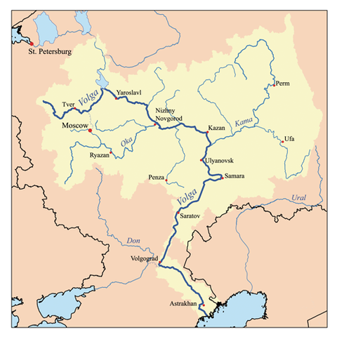
This is a map of the Volga River system. I, Karl Musser, created it based on USGS data.
|
derivative works
Derivative works of this file:
File usage
The following pages on Schools Wikipedia link to this image (list may be incomplete):
Metadata
A background to Schools Wikipedia
SOS Children's Villages has brought Wikipedia to the classroom. In 133 nations around the world, SOS Children's Villages works to bring better education and healthcare to families in desperate need of support. Have you thought about sponsoring a child?