
File:Europe, 1700 - 1714.png
Size of this preview: 640 × 437 pixels.
| |
This is a file from the Wikimedia Commons. Information from its description page there is shown below.
Commons is a freely licensed media file repository. You can help. |
| Maps of the history of Europe | |
| BC aC |
Middle Neolithic · Late Neolithic · 220 |
|
|
|
| AD dC |
60 · 125 · 395 · 400 · 450 · 476 · 526 · 526-600 · 800 · 814 · 843-870 · 998 · 1000 · 1092 · 1097 · 1135 · 1142 · 1190 · 1328 · 1360 · 1400 · C.15 · 1430 · 1470 · 1490 · 1500 · 1519 · 1550 · 1560 · 1648 · 1700 · 1708 · 1740 · 1748 · 1787 · 1812 · 1815 · 1815 · 1890 · 1905 · 1911 · 1914 · 1919 · 1919-29 · 1923 · 1941-42 · 1942-45 · 1945-89 · 1993-2006 · 2006 to date |
| (this template: · view · discuss ) | |
Summary
| Description |
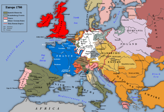
English: Map of Europe 1700. Based an image in G. M. Trevelyan's England Under Queen Anne Volume I Note: By 1700 Muscovy is Russia.
|
| Date | 8 April 2009 |
| Source | Own work |
| Author | Rebel Redcoat |
Licensing
 |
I, the copyright holder of this work, release this work into the public domain. This applies worldwide. In some countries this may not be legally possible; if so: I grant anyone the right to use this work for any purpose, without any conditions, unless such conditions are required by law.
|
File usage
The following pages on Schools Wikipedia link to this image (list may be incomplete):
Metadata
Find out about Schools Wikipedia
Wikipedia for Schools brings Wikipedia into the classroom. SOS Children is there for the children in our care until they are ready for independence. Help another child by taking out a sponsorship