 |
This is a file from the Wikimedia Commons. Information from its description page there is shown below.
Commons is a freely licensed media file repository. You can help.
|
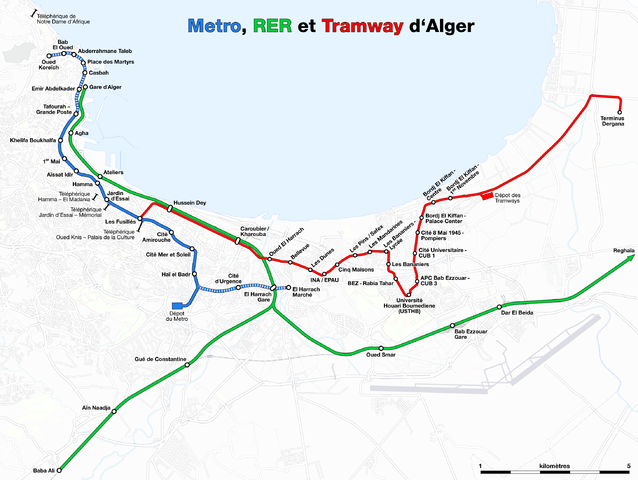
| DescriptionMetro, suburban train and tramway map of Algiers.png |
Deutsch: Karte der Metro, S-Bahn und Straßenbahn von Algier
English: Metro, suburban train and tramway map of Algiers
Français : Plan du métro, RER et tramway d'Alger
|
| Date |
see file history |
| Source |
Own work, using OpenStreetMap data for the background |
| Author |
Maximilian Dörrbecker ( Chumwa) |
Permission
( Reusing this file) |
All OpenStreetMap data and maps are Creative Commons "CC-BY-SA 2.0" licensed
|
 |
This Map image could be recreated using vector graphics as an SVG file. This has several advantages; see Commons:Media for cleanup for more information. If an SVG form of this image is already available, please upload it. After uploading an SVG, replace this template with {{ vector version available|new image name.svg}}. |
Need Assistance!
I don't live in Algiers and the map basically was drawn after some informations from the Web which are often incorrect or very inaccurate. So if you want the network map as accurate as possible too, please announce your error hints and corrections on my German discussion page.
Thank you!
File usage
The following pages on Schools Wikipedia link to this image (list may be incomplete):
Through Schools Wikipedia, SOS Children's Villages has brought learning to children around the world. In 133 nations around the world, SOS Childrens Villages works to bring better education and healthcare to families in desperate need of support. Will you help another child today?


