 |
This is a file from the Wikimedia Commons. Information from its description page there is shown below.
Commons is a freely licensed media file repository. You can help.
|
| DescriptionCarte Skagerrak-Kattegat2.png |
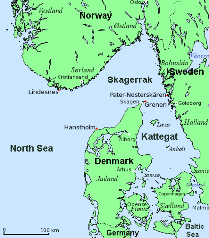
English: Map of Skagerrak and Kattegat (Denmark, Norway, Sweden). English names set. (Mercator-projection, data from 2005.)
Dansk: Kort over Skagerrak og Kattegat (Danmark, Norge, Sverige). Engelsk stednavne. (Mercator-projektion, data fra 2005.)
Deutsch: Karte von Skagerrak und Kattegat (Dänemark, Norwegen, Schweden). Englische Ortsbeschriftungen. (Mercator-Projektion, Daten von 2005.)
Français : Carte du Skagerrak et du Kattegat (Danemark, Norvège, Suède). (Projection de Mercator. Données de 2005.)
|
| Date |
2006-12-08 (original upload date) |
| Source |
English: Modification of
Dansk: Bearbejdelse af
Deutsch: Bearbeitung von http://commons.wikimedia.org/wiki/File:Carte_Skagerrak-Kattegat.png |
| Author |
Original uploader was Attilios at en.wikipedia |
Permission
( Reusing this file) |
GFDL-WITH-DISCLAIMERS; Released under the GNU Free Documentation License.
|
Licensing
 |
Permission is granted to copy, distribute and/or modify this document under the terms of the GNU Free Documentation License, Version 1.2 or any later version published by the Free Software Foundation; with no Invariant Sections, no Front-Cover Texts, and no Back-Cover Texts.
Subject to disclaimers.www.gnu.org/copyleft/fdl.htmlGFDLGNU Free Documentation Licensetruetrue
|
File usage
The following pages on Schools Wikipedia link to this image (list may be incomplete):


