 |
This is a file from the Wikimedia Commons. Information from its description page there is shown below.
Commons is a freely licensed media file repository. You can help.
|
Summary
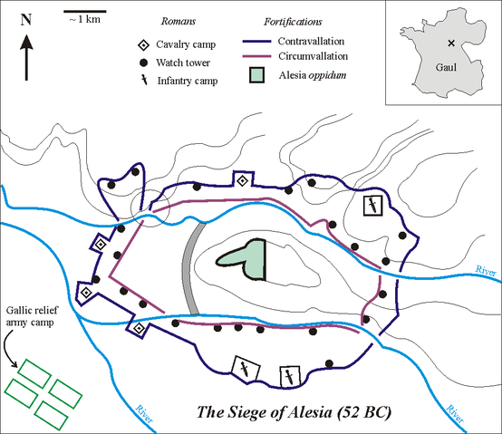
Sketch of the Battle of Alesia, drawn by Muriel Gottrop in December 2004. Inbox: cross shows location of Alesia in Gaul (modern France). The open circle shows the weakness in the contravallation line
Deutsch: Skizze der Schlacht um Alesia von Muriel Gottrop, Dezember 2004. Der Kartenausschnitt zeigt die Lage von Alesia in Gallien (heute Frankreich). Der offene Kreis zeigt die Schwachstelle in der Contravallation
Español: Las fortificaciones construidas por César en Alesia de acuerdo a la hipótesis de localización en Alise-Sainte-Reine
En el mapa de la esquina la cruz muestra la localización de Alesia en la Galia (hoy Francia). En el esquema, el círculo muestra el punto débil en la circunvalación
derivative works
Derivative works of this file:
File usage
The following pages on Schools Wikipedia link to this image (list may be incomplete):
SOS Children's Villages aims to make Wikipedia suitable for young learners. SOS Childrens Villages works in 133 countries and territories across the globe, helps more than 62,000 children, and reaches over 2 million people in total. There are many ways to help with SOS Children.


