
File:Barentsz Full Map.jpg
| |
This is a file from the Wikimedia Commons. Information from its description page there is shown below.
Commons is a freely licensed media file repository. You can help. |
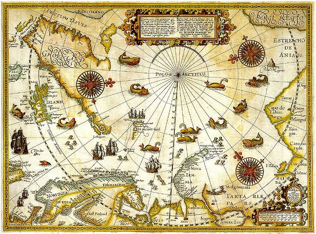
| Description | Portion of 1599 map of Arctic exploration by Willem Barentsz. Spitsbergen, here mapped for the first time, is indicated as "Het Nieuwe Land" (Dutch for "the New Land"), centre-left. |
| Date | Original map 1599. Portion published online by Tromsø University 1999 as part of the "Northern Lights Route" project of the Council of Europe. Uploaded to Commons 2006. |
| Source | University Library of Tromsø |
| Author | Willem Barentsz. |
| Permission ( Reusing this file) |
Public domain (over 70 years since creator's death) |
Licensing
 |
This image (or other media file) is in the public domain because its copyright has expired. This applies to Australia, the European Union and those countries with a copyright term of life of the author plus 70 years.
|
|
|
|
File usage
Learn more
All five editions of Schools Wikipedia were compiled by SOS Childrens Villages. Thanks to SOS Children's Villages, 62,000 children are enjoying a happy childhood, with a healthy, prosperous future ahead of them. We have helped children in Africa for many years - you can help too...