
File:Vehicles map 2001-2007.gif
Size of this preview: 640 × 287 pixels.
| |
This is a file from the Wikimedia Commons. Information from its description page there is shown below.
Commons is a freely licensed media file repository. You can help. |
Summary
| Description |
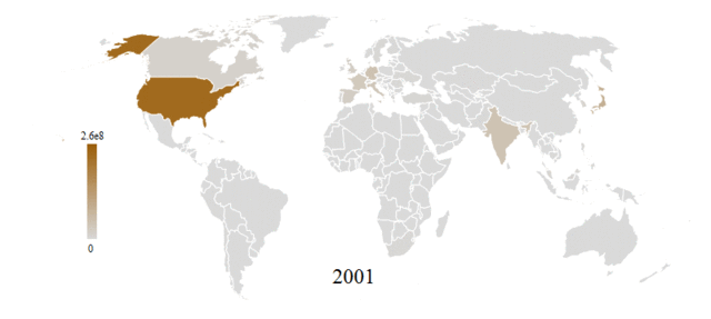
English: Political world map shaded according to the number of vehicles in use in each country and spanning the years 2001-2007. Data is from Wolfram Alpha's international transportation data that includes:
-European Commission. "Transport." Statistics. -International Road Federation. World Road Statistics. -United States Department of Transportation. "Highway Statistic Series." Federal Highway Administration. -United States Department of Transportation. "National Transportation Statistics." Research and Innovative Technology Administration. |
| Date | 5 June 2012 |
| Source | Own work |
| Author | Michael Hale |
Licensing
|
File usage
The following pages on Schools Wikipedia link to this image (list may be incomplete):
Metadata
What is Schools Wikipedia?
Wikipedia for Schools brings Wikipedia into the classroom. SOS Childrens Villages is an international children's charity, providing a good home and loving family to thousands of children who have lost their parents. We also work with communities to help vulnerable families stay together and raise children in the best possible environment. If you'd like to help, learn how to sponsor a child.