 |
This is a file from the Wikimedia Commons. Information from its description page there is shown below.
Commons is a freely licensed media file repository. You can help.
|
| Description |
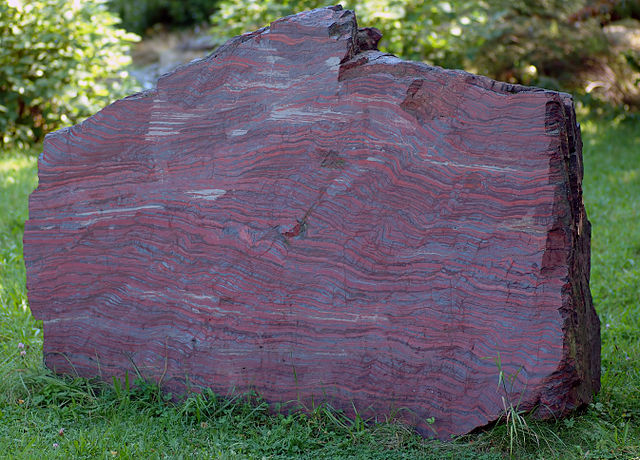
Black-band ironstone (aka).jpg English: This image shows a 2.1 billion years old rock containing black-banded ironstone, which has a weight of about 8.5 tons. The approximately two meter high, three meter wide, and one meter thick block of stone was found in North America and belongs to the National Museum of Mineralogy and Geology in Dresden, Germany. The rock is located at +51°2'34.84" +13°45'26.67".
Deutsch: Dieses Bild zeigt einen etwa 8,5 Tonnen schweren und 2,1 Milliarden Jahre alten Block mit Bändereisenerzen. Der etwa zwei Meter hohe, drei Meter breite und einen Meter tiefe Gesteinsblock wurde in Nordamerika gefunden und gehört dem Staatlichen Museum für Mineralogie und Geologie Dresden. Der Block befindet sich bei den Koordinaten +51°2'34.84" +13°45'26.67".
Português: Imagem duma antiga rocha de 8,5 toneladas de 2,1 biliões de anos, com faixas de minério de ferro. Este bloco de pedra de aproximadamente dois metros de altura, três de largura e um de espessura foi encontrado no norte da América e encontra-se em exposição no Museu Nacional de Mineralogia e Geologia em Dresden, Alemanha, em +51°2'34.84"N +13°45'26.67"E.
Русский: Здесь изображена скала возрастом 2,1 миллиарда лет, содержащую железную руду с черной каймой, вес камня приблизительно 8,5 тонн. Приблизительно два метра высотой, три метра шириной, и один метр толщиной камень был найден в Северной Америке и принадлежит Национальному музею Минералогии и Геологии в Дрездене, Германия. Скала расположена +51°2'34.84"N +13°45'26.67"E.
Camera data
- Camera Nikon D70
- Lens Tamron SP AF 90mm/2.8 Di Macro 1:1
- Focal length 90 mm
- Aperture f/2.8
- Exposure time 1/250 s
- Sensivity ISO 200
|
Please help translating the description into more languages. Thanks a lot!
If you want a license with the conditions of your choice, please email me to negotiate terms.
best new image
 |
| Date |
26 August 2005
|
| Source |
Own work
|
| Author |
André Karwath aka Aka
|
Permission
( Reusing this file) |
|
|
Camera location
|
51° 2′ 34.84″ N, 13° 45′ 26.67″ E
|
View this and other nearby images on: Google Maps - Google Earth - OpenStreetMap |
( Info)51.043011111111;13.757408333333 |
File usage
The following pages on Schools Wikipedia link to this image (list may be incomplete):


