
File:LocationByzantineEmpire 550.png
Size of this preview: 640 × 417 pixels.
| |
This is a file from the Wikimedia Commons. Information from its description page there is shown below.
Commons is a freely licensed media file repository. You can help. |
Summary
 |
This map image could be recreated using vector graphics as an SVG file. This has several advantages; see Commons:Media for cleanup for more information. If an SVG form of this image is already available, please upload it. After uploading an SVG, replace this template with {{ vector version available|new image name.svg}}. |
| Description |
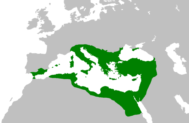
English: The extent of the Eastern (Byzantine) and Western Roman Empires in 550.
|
| Date | 6/14/08 |
| Source | Own work |
| Author | Red4tribe |
Licensing
 |
I, the copyright holder of this work, release this work into the public domain. This applies worldwide. In some countries this may not be legally possible; if so: I grant anyone the right to use this work for any purpose, without any conditions, unless such conditions are required by law.
|
File usage
The following pages on Schools Wikipedia link to this image (list may be incomplete):
About Schools Wikipedia
Schools Wikipedia was created by children's charity SOS Children's Villages. SOS Children's Villages is there for the children in our care until they are ready for independence. Will you help another child today?