 |
This is a file from the Wikimedia Commons. Information from its description page there is shown below.
Commons is a freely licensed media file repository. You can help.
|
Summary
| Description |
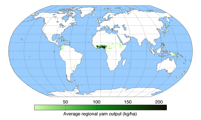
English: Map of yam production (average percentage of land used for its production times average yield in each grid cell) across the world compiled by the University of Minnesota Institute on the Environment with data from: Monfreda, C., N. Ramankutty, and J.A. Foley. 2008. Farming the planet: 2. Geographic distribution of crop areas, yields, physiological types, and net primary production in the year 2000. Global Biogeochemical Cycles 22: GB1022
|
| Date |
3 March 2003 |
| Source |
Own work |
| Author |
AndrewMT |
Licensing
I, the copyright holder of this work, hereby publish it under the following license:

 |
This file is licensed under the Creative Commons Attribution 3.0 Unported license. |
|
|
|
- You are free:
- to share – to copy, distribute and transmit the work
- to remix – to adapt the work
- Under the following conditions:
- attribution – You must attribute the work in the manner specified by the author or licensor (but not in any way that suggests that they endorse you or your use of the work).
http://creativecommons.org/licenses/by/3.0 CC-BY-3.0 Creative Commons Attribution 3.0 truetrue
|
|
File usage
The following pages on Schools Wikipedia link to this image (list may be incomplete):


