 |
This is a file from the Wikimedia Commons. Information from its description page there is shown below.
Commons is a freely licensed media file repository. You can help.
|
| DescriptionCanada Alberta location map 2.svg |
Deutsch: Positionskarte von Alberta, Kanada Quadratische Plattkarte, N-S-Streckung 170 %. Geographische Begrenzung der Karte:
- N: 60.3° N
- S: 48.7° N
- W: 123.0° W
- O: 107.0° W
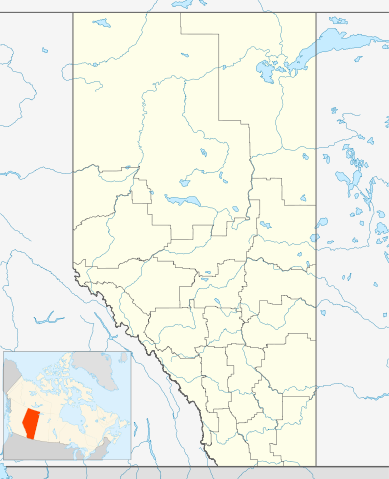
English: Location map of Alberta, Canada, showing the 19 census divisions. Equirectangular projection, N/S stretching 170%. Geographic limits of the map:
- N: 60.3° N
- S: 48.7° N
- W: 123.0° W
- E: 107.0° W
Español: Divisiones censales de Alberta
Français : Les divisions de recensement de l'Alberta
Italiano: Divisioni censuarie dell'Alberta
|
| Date |
24 September 2009 |
| Source |
Own work, File:Canada Alberta location map.svg by NordNordWest |
| Author |
Hanhil ( talk) 05:35, 24 September 2009 (UTC) |
Permission
( Reusing this file) |
|
I, the copyright holder of this work, hereby publish it under the following license:
|
|
File usage
The following pages on Schools Wikipedia link to this image (list may be incomplete):
This file contains additional information, probably added from the digital camera or scanner used to create or digitize it. If the file has been modified from its original state, some details may not fully reflect the modified file.


