 |
This is a file from the Wikimedia Commons. Information from its description page there is shown below.
Commons is a freely licensed media file repository. You can help.
|
| Description |
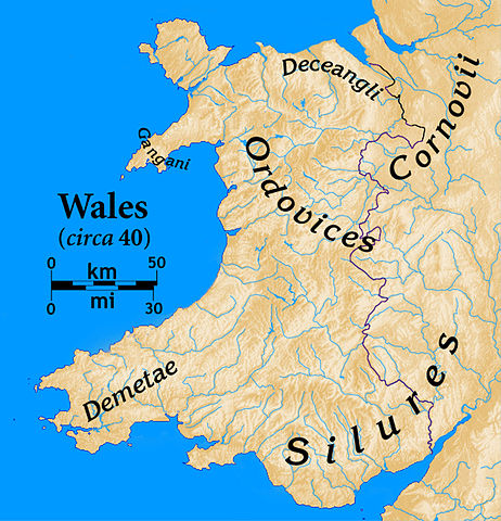
Pre-Roman Wales |
| Date |
7 October 2008 |
| Source |
sub area of Image:Uk topo en.jpg plus my additions
Data on peoples and their location is from John Edward Lloyd's 1912 History of Wales (2 vols.) |
| Author |
author of source image, plus my additions (myself) |
 |
The map has been created with the Generic Mapping Tools: http://gmt.soest.hawaii.edu/ using one or more of these public domain datasets for the relief:
- ETOPO2 ( topography/ bathymetry): http://www.ngdc.noaa.gov/mgg/global/global.html
- GLOBE ( topography): http://www.ngdc.noaa.gov/mgg/topo/gltiles.html
- SRTM ( topography): http://www2.jpl.nasa.gov/srtm/
|
 |
Permission is granted to copy, distribute and/or modify this document under the terms of the GNU Free Documentation License, Version 1.2 or any later version published by the Free Software Foundation; with no Invariant Sections, no Front-Cover Texts, and no Back-Cover Texts. A copy of the license is included in the section entitled GNU Free Documentation License. http://www.gnu.org/copyleft/fdl.htmlGFDLGNU Free Documentation Licensetruetrue
|
|
I, the copyright holder of this work, hereby publish it under the following license:
|
File usage
The following pages on Schools Wikipedia link to this image (list may be incomplete):
Through Schools Wikipedia, SOS Children's Villages has brought learning to children around the world. SOS Children is there for the children in our care until they are ready for independence. Learn more about child sponsorship.


