Mount Kilimanjaro
Did you know...
SOS Children has tried to make Wikipedia content more accessible by this schools selection. See http://www.soschildren.org/sponsor-a-child to find out about child sponsorship.
| Mountain name required |
|---|
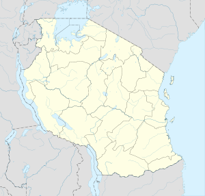
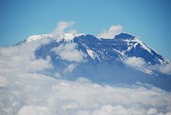
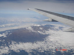
Kilimanjaro with its three volcanic cones, Kibo, Mawenzi, and Shira, is an inactive stratovolcano in north-eastern Tanzania rising 4,600 m (15,100 ft) from its base, and is additionally the highest peak in Africa at 5,895 meters (19,340 ft), providing a dramatic view from the surrounding plains.
Description
The highest point on Kilimanjaro is Uhuru Peak, on the volcano Kibo 5,895 metres (19,341 ft). The top of Kibo is a 1.5 mile wide crater. As the highest point in Africa, Uhuru Peak is one of the Seven Summits. The summit was first reached by the Marangu army scout Yohanas Kinyala Lauwo, German Hans Meyer and Austrian Ludwig Purtscheller, on October 6, 1889. Two other peaks are also extinct volcanoes: Mawenzi (5,149 m, 16,890 ft), the third highest peak in Africa (after Mount Kenya) and Shira (3,962 m, 13,000 ft). Yohanas' Notch is named after Lauwo.
Due to Kilimanjaro's equatorial location and high elevation, almost every climate type on earth is represented, including a year-round snow-topped summit.
The summit of Kilimanjaro is covered by a GSM mobile phone network, provided by Vodacom. It was previously the highest point in the world with mobile phone service; China Mobile now provides coverage at the top of Mt. Everest, the highest point in the world.
Current conditions
Climatic conditions
While the volcano appears to be dormant on the inside, events on top of the mountain draw global attention. The top of the mountain has seen a retreat of the most recent covering of glaciers, with the most recent ice cap volume dropping by more than 80% . In 2002, a study led by Ohio State University ice core paleoclimatologist Lonnie Thompson predicted that ice on top of Africa's tallest peak would be gone between 2015 and 2020 . In 2007, a team of Austrian scientists from University of Innsbruck predicted that the plateau ice cap will be gone by 2040, but some ice on the slope will remain longer due to local weather conditions . A comparison of ice core records suggests conditions today are returning to those of 11,000 years ago. A study by Philip Mote of the University of Washington in the United States and Georg Kaser of the University of Innsbruck in Austria concludes that the shrinking of Kilimanjaro's ice cap is not directly due to rising temperature but rather to decreased precipitation. In May 2008 The Tanzanian Minister for Natural Resources, Ms Shamsa Mwangunga, that there were indications that snow cover on the mountain was actually increasing. As of January 2006, the Western Breach route has been closed by the Tanzanian government following a rockslide that killed four people at Arrow Glacier Camp. The rockslide is believed to have been caused by frost action in an area that is no longer permanently frozen.
Volcanic Conditions
While it is inactive, Kilimanjaro has fumaroles that emit gas in the crater on the main summit of Kibo. Scientists concluded in 2003 that molten magma is just 400 metres (1,300 ft) below the summit crater. Several collapses and landslides have occurred on Kibo in the past, one creating the area known as the western breach.
Mapping
Early good maps of Kilimanjaro were published by the British Government's Directorate of Overseas Surveys (DOS 422 Y742) in 1963. These were based on air photography carried out as early as 1958 by the RAF. These were on a scale of 1:50,000 with contours at 100 ft intervals. These are now unavailable. Tourist mapping was first published by the Ordnance Survey in England in 1989 based on the original DOS mapping (1:100,000, 100ft intervals, DOS 522). This is now no longer available. EWP produced a map with tourist information in 1990 (1:75,000, 100m contour intervals, inset maps of Kibo and Mawenzi on 1:20,000 and 1:30,000 scales respectively and 50m contour interval). This is regularly updated and in its 4th edition. In the last few years numerous other maps have become available of various qualities.
EWP map sample (1:75,000, summit area).
Name
It is unknown where the name Kilimanjaro comes from, but a number of theories exist. European explorers had adopted it by 1860 and reported that it was its Swahili name, that Kilimanjaro breaks Kilima (Swahili for "hill, little mountain") and Njaro, whose supposed origin varies according to the theory—for some it's an ancient Swahili word for white or for shining, while for it has non-Swahili origin, e.g. Kichagga word jaro meaning caravan. The problem with all these is that they can't explain why the diminutive kilima is used instead of the proper word for mountain, mlima. A different approach is to assume that it comes from Kichagga kilmanare or kileajao meaning "which defeats the bird/leopard/caravan". However this theory can't explain the fact that Kilimanjaro was never used in Kichagga before in Europe in the mid-1800s.
In the 1880s the mountain, called Kilmanscharo in German, became a part of German East Africa after Karl Peters had persuaded local chiefs to sign treaties (a common story that Queen Victoria gave the mountain to Kaiser Wilhelm II is not true). In 1889 Uhuru Peak on Kibo was named Kaiser-Wilhelm-Spitze, which was used in the German Empire until its defeat in 1918, when the territory became British-administered Tanganyika and the name was dropped.
National Parks in the Kilimanjaro area
- Kilimanjaro National Park covers 753 km² of the mountain, and is a UNESCO World Heritage site.
- Amboseli National Park, Kenya is on the northern side.
- Tsavo National Park, Kenya lies to the east.
- Arusha National Park covers neighbouring Mt Meru.
Trekking routes up Kilimanjaro
There are several routes by which to climb Mt Kilimanjaro, namely, Marangu, Rongai, Lemosho, Shira, Umbwe and Machame. Of all the routes, Machame is by far the most scenic albeit steeper route up the mountain. The Rongai is the easiest camping route and the Marangu is also easy, but accommodation is in huts. As a result, this route tends to be very busy and ascent and descent routes are the same.
Unique vegetation
Kilimanjaro has unique vegetation such as the water holding cabbage in the tussock grassland and other plants like this, all adapted to living in alpine conditions.


