Heard Island and McDonald Islands
Did you know...
SOS Children, which runs nearly 200 sos schools in the developing world, organised this selection. See http://www.soschildren.org/sponsor-a-child to find out about child sponsorship.
| Heard and McDonald Islands | |
|---|---|
| Name as inscribed on the World Heritage List | |
 |
|
| Country | |
| Type | Natural |
| Criteria | viii, ix |
| Reference | 577 |
| UNESCO region | Asia-Pacific |
| Inscription history | |
| Inscription | 1997 (21st Session) |
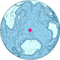
Heard Island and McDonald Islands (abbreviated as HIMI) are uninhabited, barren islands located in the Southern Ocean, about two-thirds of the way from Madagascar to Antarctica, 7718 km due south of Rajapur, Maharashtra, India and approximately 4099 km west of Perth. They have been territories of Australia since 1947, and contain the only two active volcanoes in Australian territory, one of which, Mawson Peak, is the highest Australian mountain. The group's size is 372 square kilometres (144 sq mi) in area.
History
Neither island had visitors until the mid-1850s. Peter Kemp, a British sailor, was the first person thought to have seen the island on 27 November 1833, from the brig Magnet during a voyage from Kerguelen to the Antarctic and was believed to have entered the island on his 1833 chart.
An American sealer, Captain John Heard, on the ship Oriental, sighted the island on 25 November 1853, en route from Boston to Melbourne. He reported the discovery one month later and had the island named after him. Captain William McDonald aboard the Samarang discovered the McDonald Islands close to Heard Island six weeks later, on 4 January 1854.
No landing was made on the islands until March 1855, when sailors from the Corinthian, led by Captain Erasmus Darwin Rogers, went ashore, at a place called Oil Barrel Point. In the sealing period from 1855–1880, a number of American sailors spent a year or more on the island, living in appalling conditions in dank smelly huts, also at Oil Barrel Point. At its peak the community consisted of 200 people. By 1880, most of the seal population had been wiped out and the sailors left the island. In all, more than 100,000 barrels (16,000 m3) of elephant seal oil was produced during this period.
There are a number of wrecks in the vicinity of the islands.
The islands have been a territory of Australia since 1947, and became a World Heritage Site in 1997.
Geography
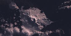
Heard Island is a 368-square-kilometre (142 sq mi) bleak and mountainous island located at 53°06′00″S 73°31′00″E. Its mountains are covered in glaciers and dominated by Mawson Peak, a 2,745-metre (9,006 ft) high complex volcano which forms part of the Big Ben massif.
Mawson Peak is the highest Australian mountain (higher than Mount Kosciuszko), and one of only 2 active volcanoes in Australian territory, the other being McDonald Island. A long thin spit named "Elephant Spit" extends from the east of the island.
There is a small group of islets and rocks about 10 kilometres (6 mi) north of Heard Island, consisting of Shag Islet, Sail Rock, Morgan Island and Black Rock. They total approximately 1.1 square kilometres (0.4 sq mi) in area.
The McDonald Islands are located 44 kilometres (27 mi) to the west of Heard Island at 53°02′20″S 72°36′04″E. The islands are small and rocky and consist of McDonald Island (230 metres (750 ft) high), Flat Island (55 metres (180 ft) high) and Meyer Rock (170 metres (560 ft) high). They total approximately 2.5 square kilometres (1.0 sq mi) in area and, as with Heard Island, are surface exposures of the Kerguelen Plateau.
McDonald Island, after being dormant for 75,000 years, erupted in 1992 and has erupted again several times since, its most recent eruption being on 10 August 2005.
Heard Island and the McDonald Islands have no ports or harbours.
Administration and economy
The islands are a territory of Australia administered from Hobart by the Australian Antarctic Division of the Australian Department of the Environment and Water Resources. They are populated by large numbers of seal and bird species. The islands are contained within a 65,000-square-kilometre (25,000 sq mi) marine reserve and are primarily visited for research.
From 1947 until 1955 there were camps of visiting scientists on Heard Island (at Atlas Cove in the northwest, which was in 1969 again occupied by American scientists and expanded in 1971 by French scientists) and in 1971 on McDonald Island (at Williams Bay). Later expeditions used a temporary base at Spit Bay in the northeast, such as in 1988, 1992–93 and 2004–2005.
There is no economic activity, but they have been assigned the country code HM in ISO 3166-1 and therefore the Internet top-level domain .hm.

