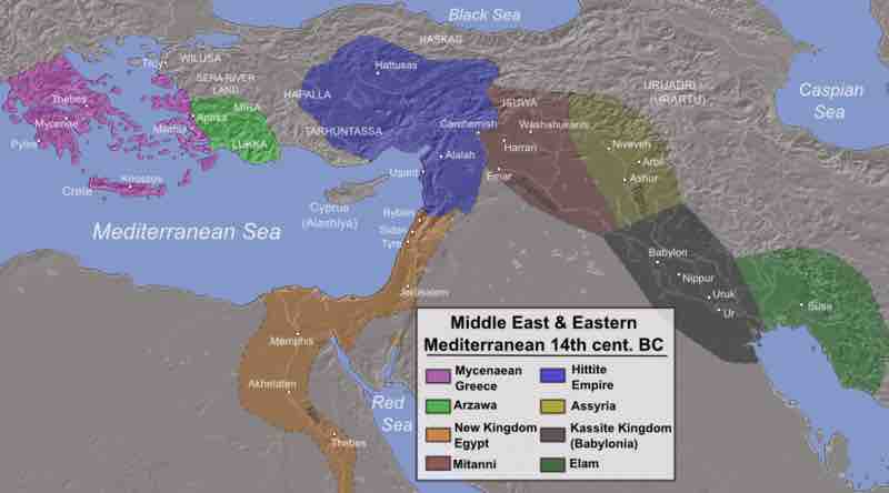
Map of the Ancient Near East during the 14th century BCE, showing the great powers of the day
This map shows the extent of the empires of Egypt (orange), Hatti (blue), the Kassite kingdom of Babylon (black), Assyria (yellow), and Mitanni (brown). The extent of the Achaean/Mycenaean civilization is shown in purple.
The map shows eight different powers and the area they occupied. From west to east, Mycenaean Greece covered modern-day Greece and the west coast of modern-day Turkey; Arzawa covered portions of modern-day Turkey; the New Kingdom of Egypt covered modern-day Egypt, as well as portions of modern-day Sudan, Palestine, Israel, Syria, Jordan, and Lebanon; the Hittite Empire covered portions of modern-day Turkey, Syria, and Lebanon; Mitanni covered portions of modern-day Syria, Turkey, and Iraq; Assyria covered portions of modern-day Syria, Iraq, and Turkey; Kassite Kingdom covered portions of modern-day Iran and Iraq; and Elam covered portions of modern-day Iran.
Source
Boundless vets and curates high-quality, openly licensed content from around the Internet. This particular resource used the following sources: